If you stumbled upon this site, and are wondering why everything is a little slow, head on over to the new address here or type in www.outsidecincy.com to stay in the loop.
Get Outside Cincinnati!
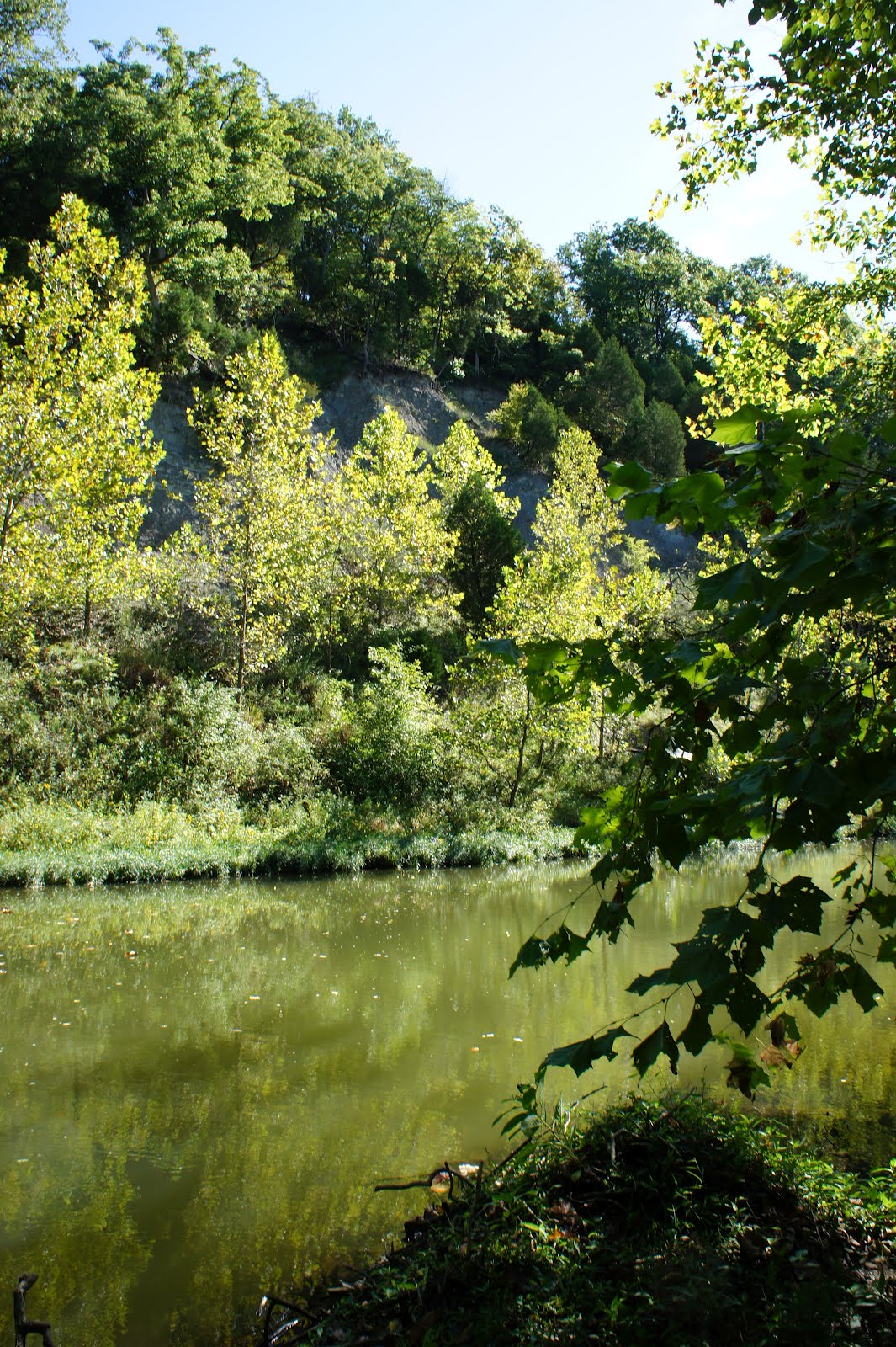
Monday, November 19, 2012
Thursday, March 8, 2012
Hike... Tar Hollow State Park
Located outside of Chillicothe, around 2 hours out of Cincinnati, Tar Hollow state park and the surrounding state forest offers a wide variety of outdoor activities. Just far enough away to make a weekend trip, but still close enough to make it a day trip, this park offers topography that you just cannot find in the Cincinnati Tri-State area.

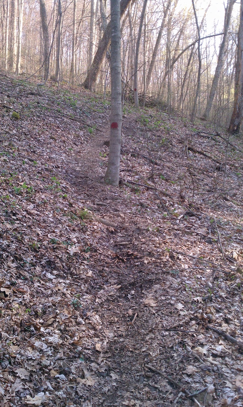
One of the best features of this park is their Logan Trail. Totaling 21 miles, this trail is split into the north and south loops. Pick one loop to make a great day hike, or hike both with a pack for a great, secluded overnight trip. A total of five primitive campsites are located at the fire tower, which is the connecting point for the north and south loops.

Other trails are located at the park, the Ross Hollow trail which loops around the ridge above the campground, totals 3.5 miles. Also, a section of the Buckeye Trail runs through the park, which is one of the toughest sections of the trail. Steep, steep hills in this park. Definitely worth the drive!
Address:
16396 Tar Hollow Road
Laurelville, Ohio 43135
Get Outside Cincinnati!
Pedal... Landen Deerfield Park.

Located in the middle of a neighborhood, Landen Deerfield park is a well hidden mountain bike trail. From Montgomery Rd. the most noticeable feature of the park is the ball fields. Once arriving, this looks like your typical sports complex type park. Once looking a little deeper though, you will find an amazing trail that stays pretty hidden.
The trail head is near a shelter house at the back of the park, which is directly beside the power lines that cross the park. Also at the shelter, there is a sign with trail information. Behind the shelter is where you enter the woods.

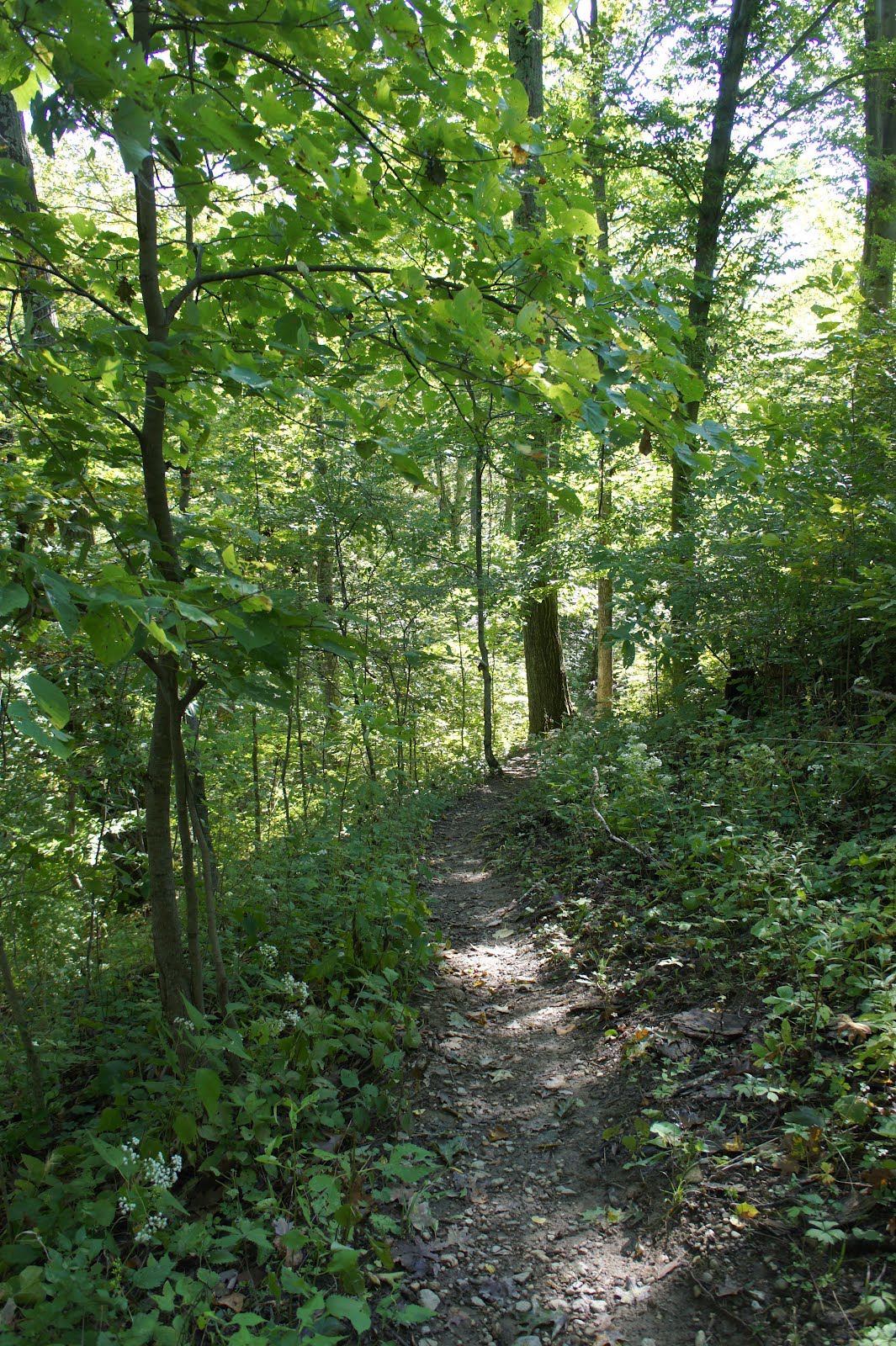
Once on the trail, try to follow the blue blazes on the trees. The trail is not marked as well as it could be, but it is pretty straight forward and easy to follow. Just follow the most worn down trail, and you will ride the entire loop.

Total mileage for the loop is close to 3 miles, but it is interesting enough to ride multiple loops with interesting creek crossings, tight single track, a few interesting climbs, and a fun rock garden. My favorite part of this trail is that you do not need to load up with tools and gear, as you are just a short walk to your car if you have an issue. Just grab a water bottle and ride!
The park is off of Montgomery Rd. not too far past Field's Ertl Rd. Easy access from I71. Address:
2257 West State Route 22/3
Landen, OH
Get Outside Cincinnati!
Find more Mtn Biking in Maineville, OH
Map via Map My Ride.
Monday, February 27, 2012
Pack... Shawnee State Park and Forest.
By Kim Klosterman and Atom Martinez.
Located in the southern portion of the state, Shawnee State Forest is an ideal getaway from the greater Cincinnati area. Being the largest state forest in Ohio at 63,000 acres, it is commonly known as the "Little Smokies" for it's steep hills and similar, smaller scenery.
The main campground is located in the center of the forest, but that was not the plan for our last two trips to the area. Our plan was to escape the city, and relax for an overnighter in the foothills of Appalachia. Here are our experiences in this great park.
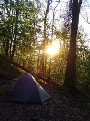
In early May, we loaded up and drove the 3.5 hour trip from Cincinnati to Shawnee State Park. The backpacking trail is 40 miles total, but we only planned for an overnight trip. We choose to hike into campsite #7 from the main registration area, spend the night, and hike back to our car the following day. This hike along the South Loop is only 4.5 miles, but due to the extremely steep terrain, it feels way more than that. So our advice: pack light! The campsite is a cozy setting down in the valley, with a small stream running nearby. Although this is a nice little site, the main problem is that the area stays very wet in the spring. This creates an ideal setting for ticks, and during this trip the ticks were out of control. To be honest, we quit counting after 30! This wasn’t the end of the world for us, but if you are going to check out this area in the spring, make sure you bring a fellow primate along for the excursion, if only to have someone to pick the ticks off of your back. One other issue to mention about this site is to keep your safety in mind when pitching your tent, as there are more than a few dead, standing trees around this site.
 Treehugger.
From our impression, the nickname "The Little Smokies," is much more of a compliment than what it lives up to. Don’t get us wrong, this park is way beautiful in its own right, but given the steep inclines, the whip-poor-wills keeping us up all night long, and the amount of ticks we accumulated; this trip was a memorable one, but not necessarily one of our favorites. Since we had a trail map, we opted to hike the gravel road out the next morning via the Lampblack trail, instead of taking the steep trail we had traveled the day before back to the car. And I have to say, my shins were really happy with that decision!
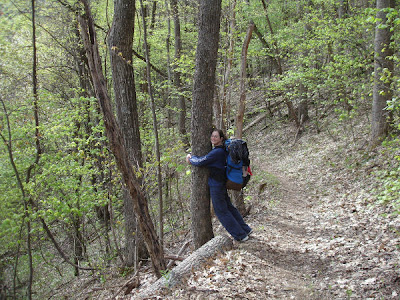
That following October Atom returned for a solo trip to hike to Campsite #1 along the North Loop. This hike along the same rugged, steep terrain didn't seem quite as grueling for the 6.2 mile hike, due to the amazing scenery of the fall colors and the diversity of plant life along the way. For Atom, one great highlight of his trip was finding Witch Hazel growing in the wild for the first time! After a tough 5.5 miles, the trail started to find itself bordered by humongous Eastern Hemlocks trees. If you like trees like we do, finding trees of this caliber can completely re-energize you, and remind you why you hike and pack for "vacation." This gave Atom a needed boost of moral and he continued on to his destination.
 Atom filtering some H2O.
The campsite is probably a half a mile off the trail, and has at least 2 or 3 areas for different groups to settle down in. There are a dozen or so different species of trees surrounding this site. Again, for the tree lovers out there, this is an awesome place to set up camp, as it includes: Sweet gums, Sassafras, Hickories, Oaks, Tulip poplars, Red and Sugar Maples and many more.
After setting up his tent, starting a small fire, and drinking some rum, he sat quietly listening to Eastern Screech Owls whinnying into the night. It was a great, peaceful way to end the day. Overall, Atom would say he prefers this campsite over campsite #7.
These are just a couple great options for getting out of the city and into the woods, as the park is just a few hours drive away. A total of 40 miles of backpacking trail is available, with 7 back-country campsites, not to mention a fully stocked State Park with all the camping amenities that you could possibly think of.
Get Outside Cincinnati!
Photos by Kim Klosterman and Atom Martinez.

Located in the southern portion of the state, Shawnee State Forest is an ideal getaway from the greater Cincinnati area. Being the largest state forest in Ohio at 63,000 acres, it is commonly known as the "Little Smokies" for it's steep hills and similar, smaller scenery.
The main campground is located in the center of the forest, but that was not the plan for our last two trips to the area. Our plan was to escape the city, and relax for an overnighter in the foothills of Appalachia. Here are our experiences in this great park.
In early May, we loaded up and drove the 3.5 hour trip from Cincinnati to Shawnee State Park. The backpacking trail is 40 miles total, but we only planned for an overnight trip. We choose to hike into campsite #7 from the main registration area, spend the night, and hike back to our car the following day. This hike along the South Loop is only 4.5 miles, but due to the extremely steep terrain, it feels way more than that. So our advice: pack light! The campsite is a cozy setting down in the valley, with a small stream running nearby. Although this is a nice little site, the main problem is that the area stays very wet in the spring. This creates an ideal setting for ticks, and during this trip the ticks were out of control. To be honest, we quit counting after 30! This wasn’t the end of the world for us, but if you are going to check out this area in the spring, make sure you bring a fellow primate along for the excursion, if only to have someone to pick the ticks off of your back. One other issue to mention about this site is to keep your safety in mind when pitching your tent, as there are more than a few dead, standing trees around this site.

From our impression, the nickname "The Little Smokies," is much more of a compliment than what it lives up to. Don’t get us wrong, this park is way beautiful in its own right, but given the steep inclines, the whip-poor-wills keeping us up all night long, and the amount of ticks we accumulated; this trip was a memorable one, but not necessarily one of our favorites. Since we had a trail map, we opted to hike the gravel road out the next morning via the Lampblack trail, instead of taking the steep trail we had traveled the day before back to the car. And I have to say, my shins were really happy with that decision!
That following October Atom returned for a solo trip to hike to Campsite #1 along the North Loop. This hike along the same rugged, steep terrain didn't seem quite as grueling for the 6.2 mile hike, due to the amazing scenery of the fall colors and the diversity of plant life along the way. For Atom, one great highlight of his trip was finding Witch Hazel growing in the wild for the first time! After a tough 5.5 miles, the trail started to find itself bordered by humongous Eastern Hemlocks trees. If you like trees like we do, finding trees of this caliber can completely re-energize you, and remind you why you hike and pack for "vacation." This gave Atom a needed boost of moral and he continued on to his destination.

The campsite is probably a half a mile off the trail, and has at least 2 or 3 areas for different groups to settle down in. There are a dozen or so different species of trees surrounding this site. Again, for the tree lovers out there, this is an awesome place to set up camp, as it includes: Sweet gums, Sassafras, Hickories, Oaks, Tulip poplars, Red and Sugar Maples and many more.
After setting up his tent, starting a small fire, and drinking some rum, he sat quietly listening to Eastern Screech Owls whinnying into the night. It was a great, peaceful way to end the day. Overall, Atom would say he prefers this campsite over campsite #7.
These are just a couple great options for getting out of the city and into the woods, as the park is just a few hours drive away. A total of 40 miles of backpacking trail is available, with 7 back-country campsites, not to mention a fully stocked State Park with all the camping amenities that you could possibly think of.
Get Outside Cincinnati!
Photos by Kim Klosterman and Atom Martinez.
Friday, February 17, 2012
Hike... Stonelick State Park.

Situated in the woods of Clermont County, Stonelick state park is off of the beaten path for most outdoor seeking enthusiasts. Which with the lack of visitors, makes for a very relaxing nature experience.
Just far enough away to make it a day trip, but close enough for multiple visits, Stonelick state park has a lot to offer. The park has over 1000 acres to explore, including the serene 200 acre lake. Also at the park is over 5 miles of hiking trails, which surprisingly are open to mountain biking as well. These trails are mostly, if not all flat, which are great for kids. These trails would also be great for winter mountain biking adventures in the snow. Remember, only ride the trails during this time of year when the temperatures are below freezing to avoid damaging the trail system. All in all, a great park to escape to to get away from city living.
Address:
2895 Lake Drive
Pleasant Plain, Ohio 45162
Get Outside Cincinnati!

Thursday, February 16, 2012
Hike... Caesar Creek Gorge State Nature Preserve.

Caesar Creek State Nature Preserve, nestled away in Warren county, boasts 483 acres of land just below the state park of the same name. This little preserve has a very interesting layout, with a 2.25 mile loop trail that follows the waterway giving great views of the gorge. A nice, easy hike that is great for the whole family, it is mostly flat, until you start to climb out of the floodplain. A short, but steep climb brings you up above the gorge, and you finish the hike in a wooded trail that loops around and brings you back to your car. This preserve is also across the road from a Little Miami river canoe access.

This is a great area to visit, and also to introduce the younger members of your family to hiking. A great area for Spring wildflowers, birdwatching, or just a place to escape the city and relax in nature. Not very many people take advantage of this preserve, go see for yourself!
Get Outside Cincinnati!
To get here:
Take Interstate 71 north from Cincinnati to SR 73. Take SR73 west to Corwin Rd.
Address:
4080 Corwin Rd
Oregonia, OH 45054
Map with elevation:
Find more Other in Waynesville, OH
Wednesday, February 15, 2012
Pedal... East Fork State Park

One of the longer and more established mountain bike trails in the area, East Fork State Park has what you are looking for. Smooth lines, tight twisty single track, a few surprising climbs, and even a couple rock gardens. East Fork definitely deserves to be on your short list of trails to ride.
The trail is split into three sections, the South, Middle, and North trails, with the North also being called the "Tec Trail." The North section has a bit more climbing, and a few other more technical features, but nothing over the level of a novice cyclist. Always remember when riding, if you do not think you can ride a section, walk it. No shame in that.
Total miles for all three trails ends up around 7.5 miles. Ride the whole system as an out and back style ride and you end up around 15 miles. Not bad at all. Word on the street is, there will be more trails added this year. Definitely something to look forward to on an already great trail system.
Not too far outside of Cincinnati, around 20-25 minutes from the Interstate 275. The trail head is off of State Route 125. Coming from Cincinnati, turn left off of SR 125, following the signs for East Fork State Park. Parking is across the street from the park office.
Address:
3294 Elklick Road
Bethel, OH 45106
Get Outside Cincinnati!

Subscribe to:
Posts (Atom)